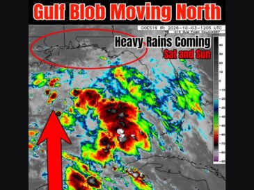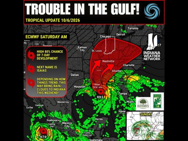
INDIANAPOLIS, IN — A disturbance in the Gulf, known as Invest 92L, now has a high 80 percent chance of development over the next seven days. If it becomes a tropical storm, it will be named Isaias. Guidance remains uncertain on its strength, with outcomes ranging from a tropical depression to the season’s first hurricane. Depending on how the system tracks, moisture could be pulled north into Indiana this weekend, bringing more clouds and rain chances by Sunday.
Invest 92L Sits Near Mexico With High Development Odds
Invest 92L is currently located near the coast of Mexico in the Gulf. The disturbance has been monitored over the past 24 to 36 hours and is showing growing signs of organization.
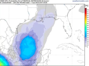
Development chances now stand at 80 percent over the next seven days. Forecast guidance is still split on whether it becomes a depression, a tropical storm, or a hurricane.
Possible First Hurricane Could Match a 1905 Record
If the system becomes a hurricane on or after October 8, it would tie or break a long-standing benchmark. The 1905 season holds the record for the latest first hurricane, which formed on October 8, 1905.
That record dates back to the era before satellite observations. A hurricane forming this late would mark a rare milestone for the Atlantic hurricane season.
European Model Shows a 993 Millibar Low Near Louisiana Saturday
One European model run shows the system positioned just south of the Louisiana coast near New Orleans on Saturday morning. The projected pressure of 993 millibars suggests a tropical storm-strength system at that time.
By Sunday, the same run shows the low weakening to about 1003 millibars as it moves inland over the Deep South. Arrows on the projection show moisture being pulled north through Mississippi, Alabama, and Tennessee.
Moisture Plume Could Reach Indiana and the Ohio Valley Sunday
The projected moisture plume stretches north from the Gulf Coast through Nashville toward Indiana, Kentucky, and Ohio. Some of that moisture could bring increased clouds and rain chances to Indiana around Sunday.
If clouds and rain arrive, high temperatures on Sunday could end up lower than currently forecast. Dry air and high pressure over Indiana will play a major role in how far north the moisture reaches.
Gulf Coast and Midwest Residents Should Monitor the Trends
Residents along the Gulf Coast, especially in Louisiana, should closely watch forecast updates as the system develops. Track and strength details will become clearer once the disturbance organizes further.
Indiana residents should also keep an eye on weekend forecasts, since rain chances will depend on the final track. A separate strong system off Mexico’s Pacific coast is also being watched, though it is not expected to affect the Gulf.
Stay with bananatreenews.today for the latest weather updates and local forecast coverage.