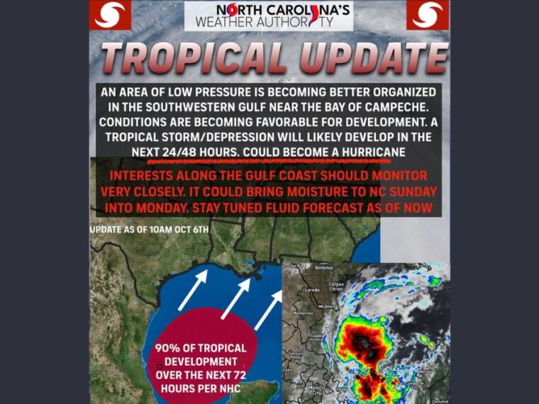
PENSACOLA, FL — Showers and thunderstorms in the southwestern Gulf are showing signs of organization around a broad area of low pressure near the Bay of Campeche. The National Hurricane Center has raised the odds of development to 90 percent, and the system is already looking better organized. A tropical depression or tropical storm is likely to form within the next 24 to 48 hours, and a hurricane cannot be ruled out before landfall along the Gulf Coast. If it becomes a named storm, it will be called Isaias.
Development Odds Climb to 90 Percent Near the Bay of Campeche
The low pressure area is becoming better organized in the southwestern Gulf near the Bay of Campeche. Conditions are becoming more favorable for development as thunderstorms continue to build.
The system is expected to become at least a tropical storm over the next 48 to 72 hours. Hurricane Hunters are scheduled to begin investigating the system later today.
Faster Movement Could Mean a Stronger Storm
The system faces some obstacles, but its speed will play a big role in how strong it becomes. A faster-developing storm moving northeast would have warm ocean waters and a break in wind shear to work with.
Those conditions could allow the system to strengthen quickly. A slower-moving storm would face more wind shear, which could limit how strong it becomes before reaching land.
Louisiana to the Florida Panhandle Should Monitor Closely
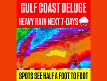
The system is expected to turn northeast into the middle of the Gulf over the coming days. Impacts are possible along the Gulf Coast from Louisiana to Florida late this week into the weekend.
It is still too early to determine specific impacts along the northern Gulf Coast. Residents from Louisiana through the Florida Panhandle should closely monitor the progress of this system.
Leftover Moisture Could Reach North Carolina Sunday Into Monday
After landfall, the system could bring leftover impacts to parts of the Southeast, including North Carolina. Rain could reach the state Sunday into Monday, though details remain unclear.
Areas on the east side of the storm could also see some severe weather develop. It is still too soon to know whether North Carolina will see significant direct or indirect impacts.
No Need to Panic but Stay Alert for Updates
The forecast remains fluid, and changes are likely as the system organizes. There is no need to panic right now, but residents along the Gulf Coast and in the Southeast should keep an eye on updates.
Now is a good time to review hurricane plans and check emergency supplies. Regular updates will continue as the storm’s track and strength become clearer.
Stay with bananatreenews.today for the latest weather updates and local forecast coverage.