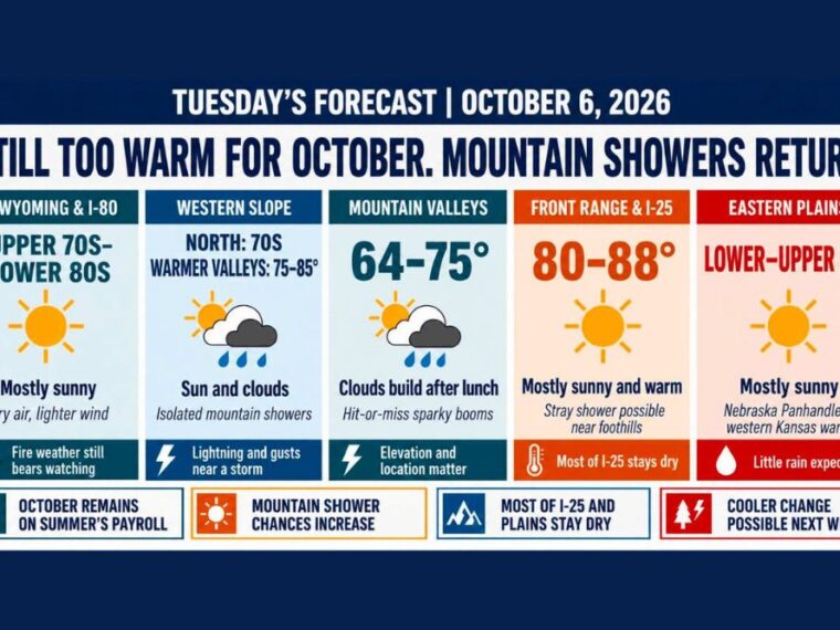
DENVER, CO — October continues to feel like summer across Colorado and the surrounding region, with temperatures running well above average Tuesday. Some areas will be a few degrees cooler than Monday, but most locations stay dry and warm. The mountains have a better chance of hit-or-miss showers and a few weak thunderstorms during the afternoon. A more meaningful pattern change may arrive Sunday into early next week with a cooler and windy storm system.
Front Range and I-25 Corridor Stay Unseasonably Warm
The Front Range and Interstate 25 corridor will see mostly sunny skies with highs from the lower to upper 80s. Denver is expected to reach the mid-80s, while northern Colorado could run slightly warmer.
A stray shower could drift toward the foothills or the Palmer Divide during the afternoon. Most of the I-25 corridor is expected to stay dry through the day.
Mountain Valleys and Western Slope See Afternoon Storm Chances
Colorado’s mountain valleys will see highs from the mid-60s to mid-70s, depending on elevation. Clouds will build after lunch, with scattered, hit-or-miss showers favoring higher terrain.
On the Western Slope, northern areas reach the 70s, while warmer valleys climb into the upper 70s to mid-80s. A few showers or storms may develop over the central and southern mountains, bringing lightning and gusty winds to anyone nearby.
Southeast Wyoming Stays Dry With Fire Weather Concerns
Southeast Wyoming and the Interstate 80 corridor will see mostly sunny skies with highs from the upper 70s into the lower 80s. Winds are expected to be lighter than on Monday.
The air remains very dry, keeping fire weather concerns in place. Residents should be careful with anything that could spark a fire.
Eastern Plains, Nebraska Panhandle, and Western Kansas Run Warm
The eastern Colorado plains will be mostly sunny and warm, with highs largely in the 80s and slim rain chances. The Nebraska Panhandle will see highs mainly in the mid to upper 80s, with Scottsbluff possibly reaching the upper end of that range.
Western Kansas will also be mostly sunny, with highs in the mid to upper 80s. Winds across western Kansas are expected to be lighter than on Monday.
Cooler and Windy Pattern Change Possible Next Week
Temperatures will ease down a few degrees Wednesday through the end of the week but remain above average. The mountains may see another isolated afternoon shower, while lower elevations stay mostly dry.
A cooler and windy storm system could arrive Sunday into early next week. How much precipitation reaches the region remains uncertain, but much cooler temperatures and wind are expected heading into next week.
Stay with bananatreenews.today for the latest weather updates and local forecast coverage.