BIRMINGHAM, AL — Drier and cooler air is returning to Alabama on Monday, with morning clouds giving way to more sunshine this afternoon. Highs will range from the upper 70s in north Alabama to the low 80s farther south. Temperatures will tumble into the 50s and low 60s tonight as skies clear. Meanwhile, a tropical system could gradually develop over the southwestern Gulf later this week, possibly bringing wet weather to Alabama by the weekend.
Sunshine Returns With Highs From Upper 70s to Low 80s
Clouds will gradually clear Monday afternoon, allowing more sunshine across Alabama. Highs are expected to reach the upper 70s across the north and the low 80s across south Alabama.
A northeast breeze of 5 to 10 mph will continue through the day before becoming lighter tonight. The drier air will make conditions feel more comfortable than in recent days.
Overnight Lows Drop Into the 50s Across North Alabama
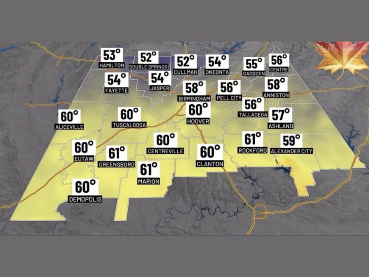
The coolest readings tonight will be in north Alabama, with Double Springs and Cullman dropping to 52 degrees and Hamilton to 53. Fayette, Jasper, and Oneonta are expected near 54, while Gadsden reaches 55.
Birmingham and Anniston are forecast near 58, with Pell City and Talladega near 56. Hoover, Tuscaloosa, Clanton, Demopolis, and Centreville will be near 60, while Greensboro, Marion, and Rockford stay closer to 61.
Drought Continues as Bigger Temperature Swings Return
Sunday’s rain was a welcome sight but was not nearly enough to end the drought across Alabama. The ground is expected to dry out quickly, leading to larger swings between daytime highs and overnight lows.
Nights and early mornings will bring a true fall feel, while afternoon sunshine could still push temperatures into the 80s. Very pleasant weather is expected through midweek.
Tropical Depression Likely in the Southwestern Gulf Later This Week
A tropical system could gradually develop over the southwestern Gulf later this week. Ensemble guidance shows a good chance of a tropical depression forming, though conditions are only marginally favorable for development.
The system could become a named storm, with Isaias next on the list. However, the chances of it becoming a major system appear low at this time.
Wet Weekend Possible as System Drifts Toward the Gulf Coast
Ensemble guidance generally favors the system drifting north toward the Gulf Coast over the weekend before turning more toward the northeast. There is still considerable spread in the exact track and timing of that turn.
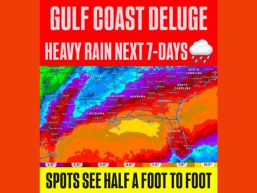
A surge of tropical moisture ahead of the system could bring showers lifting north into Alabama as early as Saturday. Wet weather is most likely late Saturday into Sunday, though a washout is not expected at this time.
Stay with bananatreenews.today for the latest weather updates and local forecast coverage.