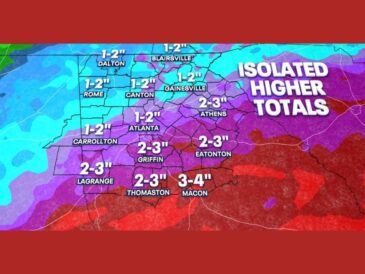
COLUMBIA, SC — A wedge boundary pushed much farther south overnight, taking the main focus for rain with it toward Interstate 20 and the coast. Some areas will see expected rainfall totals cut in half, while others may get very little additional rain at all. One last surge of showers is possible later this evening, but most of the region should stay dry Sunday. Cooler air pushing in from the northeast is also making temperatures noticeably cooler underneath the wedge.
Wedge Boundary Stretches From Atlanta to Charleston
The wedge boundary now runs from near Atlanta east across central Georgia toward the area north of Charleston. From there, it extends offshore into the Atlantic.
North of the boundary, cool and mostly dry air has settled over Charlotte, Columbia, Asheville, and much of the Carolinas. South of it, rain and storms remain active, especially near the coast and over Gulf and Atlantic waters.
Heaviest Rain Shifts Offshore Near Charleston and Myrtle Beach
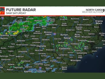
Some of the strongest storms on radar Sunday are located offshore east of Charleston and Myrtle Beach. Heavier cells were also showing up near the coast around Wilmington and New Bern.
Showers continue south of the boundary near Savannah, Statesboro, Brunswick, and Jacksonville. Lighter rain was also spreading across southern Georgia near Macon, Columbus, Albany, and Valdosta, as well as Tallahassee.
Cooler Wedge Air Brings Noticeable Temperature Drop
The wedge is bringing cooler air in from the northeast, which helped push the boundary farther south than expected. Temperatures are running noticeably cooler across areas under the wedge, including Charlotte, Columbia, and Greenville.
That cooler air is giving many areas a drier and more comfortable Sunday. Clouds may linger, but rain chances are low for most communities north of the boundary.
Forecast Models Struggled With the Boundary Position
Forecast data did not handle the position of this boundary well, and it ultimately pushed farther south than expected. That shift changed rainfall outcomes for many communities across the region.
Some residents are welcoming a drier Sunday, while others were counting on the rain. Many people adjusted weekend plans based on the earlier forecast for heavier rain.
Cool, Crisp Week Ahead Before Next Weekend’s Rain Chance
Skies are expected to clear out for a beautiful, cool, and crisp week ahead across the region. Fall-like conditions should make for comfortable weather through the workweek.
Another rainmaker may arrive next weekend, with current timing favoring Saturday night into Sunday. Forecasters will be watching that system closely as the week goes on.
Stay with bananatreenews.today for the latest weather updates and local forecast coverage.