BIRMINGHAM, AL — Beautiful weather continues across Alabama today and Thursday, but attention remains on the developing tropical system in the Gulf. The latest National Hurricane Center forecast brings the system to hurricane strength before a Gulf Coast landfall this weekend. Significant impacts are possible along the coast beginning as early as Friday evening. Rain will spread into Central Alabama late Friday night and continue Saturday, which has been declared a First Alert Weather Day.
Gulf Coast Faces Potentially Significant Impacts
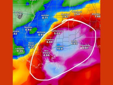
Conditions along the Gulf Coast will be much more significant than those expected in Central Alabama. Depending on the final track and strength, impacts could include tropical storm to hurricane-force wind gusts, storm surge, and flooding.
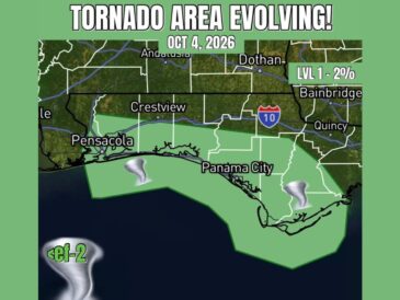
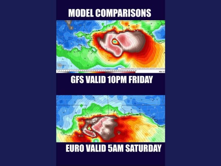
Isolated tornadoes, waterspouts, dangerous surf, and rip currents are also possible. Model wind gust projections show the strongest gusts just offshore, near 80 mph, with gusts in the 60s possible near the coast.
Some Weakening Possible Near the Coast
Some weakening could occur near the coast if the system runs into increasing wind shear. Even so, significant impacts remain possible along portions of the Gulf Coast.
Uncertainty remains in the exact track. The overnight GFS shifted farther east near landfall, while the European model and other guidance stayed farther west.
Central Alabama Sees Rain, Gusty Winds, and Isolated Tornadoes
The system will weaken considerably after moving inland, but newer guidance shows it moving faster. Rain will spread north across Central Alabama late Friday night and continue through Saturday.
Wind gusts of 20 to 30 mph are possible Saturday afternoon, especially closer to the track of the low. Areas east of the center also face a risk of isolated tornadoes, mainly during the daytime as instability increases.
Faster Trend Could End Impacts by Saturday Evening
If the faster trend continues, impacts could decrease fairly quickly by Saturday evening. That could allow the First Alert Weather Day for Sunday to be canceled.
A faster system would also favor a more abrupt end to impacts for the Alabama and Georgia game. However, fast-moving systems transitioning into mid-latitude lows can still produce strong wind gusts.
Residents Should Prepare and Check Back Frequently
Gulf Coast residents should prepare now for potentially significant impacts beginning as early as Friday evening. Central Alabama residents should prepare for rain late Friday night, along with gusty winds and isolated tornadoes Saturday.
More aircraft reconnaissance today should help refine the track and intensity forecast. Small changes in the track will determine which areas face the greatest tornado risk.
Stay with bananatreenews.today for the latest weather updates and local forecast coverage.