HOUSTON, TX — A Flood Watch is in effect until 7 PM Friday for a large part of Southeast Texas, including the city of Houston and Harris County. A slow-moving boundary entering the Houston area is interacting with tropical air and a moist Gulf feed, setting up repeated rounds of heavy rain. The greatest concern runs from Thursday night through Friday morning, especially north and west of downtown Houston. Drivers heading out before sunrise should be prepared for flooded roadways.
Flood Watch Stretches From Houston to College Station and Victoria
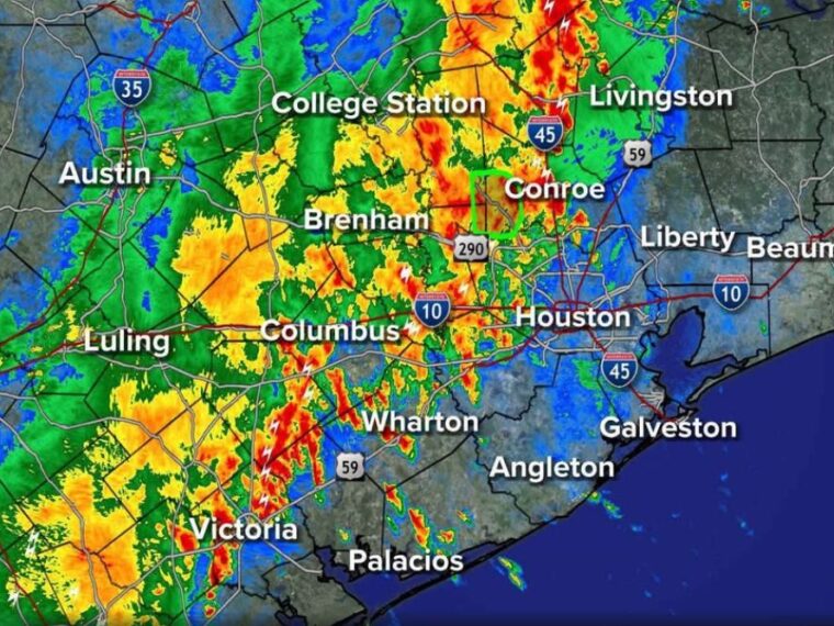
The Flood Watch covers Houston, Conroe, College Station, Brenham, Columbus, Wharton, and areas around Victoria. The highlighted zone also extends west toward the Austin area and Interstate 35 corridor.
Areas east and south of Houston, including Liberty, Beaumont, Galveston, and Angleton, are not included in the watch. The focus remains on the central and western parts of the region, where the heaviest rain is expected to fall.
Slow-Moving Boundary and Gulf Moisture Drive the Heavy Rain Threat
The setup involves a slow-moving boundary pushing into Houston while tropical air sits overhead. A steady feed of moist Gulf air is running into that boundary, giving storms a constant supply of moisture.
That combination is expected to produce slow-moving heavy downpours off and on through the night. Storms that move slowly or repeatedly track over the same areas can quickly cause street flooding and rising water.
Radar Shows Heavy Rain From College Station to Wharton and Victoria
Radar at 8:10 PM Thursday showed widespread heavy rain across areas near College Station, Brenham, Columbus, Wharton, and Victoria. Several pockets of intense rainfall and lightning were showing up from Wharton southwest toward Victoria.
Heavy rain was also building near Conroe north of Houston, while lighter rain was spreading over the Houston metro. Areas along the coast near Galveston and Beaumont were seeing much less activity at the time.
North and West Houston Face the Highest Overnight Flooding Risk
The heaviest downpours are expected to focus north and west of downtown Houston through the overnight hours. Neighborhoods in those areas could see the quickest rises in water on streets and in low-lying spots.
Rainfall rates may vary sharply from one area to the next as storms stall or train over the same locations. Conditions could change quickly before sunrise Friday as the boundary continues moving slowly through the region.
Friday Morning Commuters Should Check Road Conditions Before Leaving
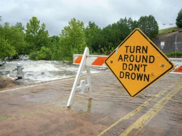
Anyone who must be on the roadways before sunrise Friday should stay alert for flooded streets and underpasses. Drivers should never attempt to cross water-covered roads, since depth and current can be hard to judge in the dark.
Residents should check the latest radar and local traffic updates Friday morning before heading out to see where problem spots have developed. The Flood Watch remains in effect through 7 PM Friday evening.
Stay with bananatreenews.today for the latest weather updates and local forecast coverage.