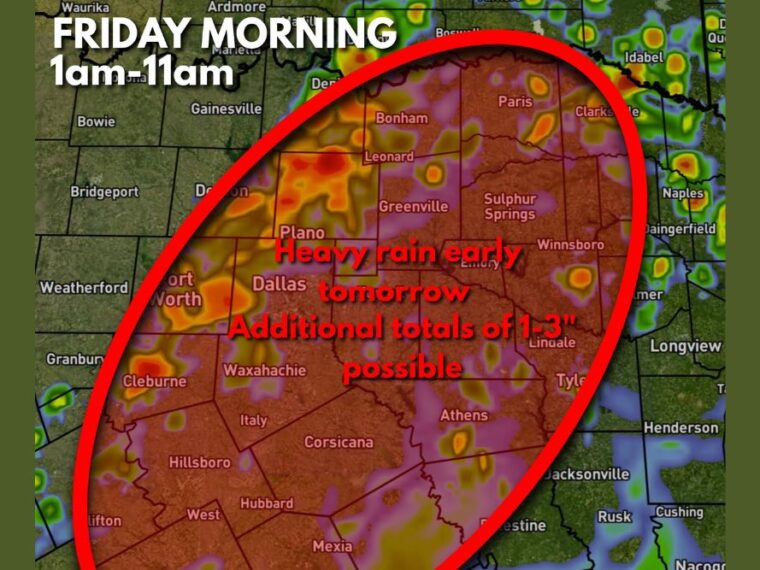
DALLAS, TX — More heavy rain is expected across North Texas from 1 AM to 11 AM Friday morning, mainly in areas east of Interstate 35. Additional totals of 1 to 3 inches are possible, with locally higher amounts in a few spots. Many instances of flash flooding have already been reported across North Texas, including multiple water rescues in the metroplex. This next round of rain is likely to cause additional flooding issues on already saturated ground.
Heavy Rain Zone Covers Dallas, Fort Worth, and the Eastern Metroplex
The highlighted heavy rain zone stretches across Fort Worth, Dallas, Plano, and areas near Denton. Some of the most intense rainfall on the projection is shown between Denton and Plano, along with pockets near Fort Worth and Cleburne.
Waxahachie, Italy, and surrounding communities south of Dallas also fall within the heavy rain area. Rain in these locations could quickly lead to street flooding given how much water has already fallen.
Northeast Texas From Bonham to Paris Faces Heavy Downpours
The heavy rain zone extends northeast across Bonham, Leonard, Greenville, and Paris. Heavier cells are shown near Paris and Clarksville, where localized higher totals are possible.
Sulphur Springs, Emory, and Winnsboro are also inside the outlined area. Rural roads and low-water crossings in these communities could become dangerous as rain totals add up through the morning.
Rain Stretches South Through Corsicana, Athens, and Tyler
The southern part of the heavy rain area includes Hillsboro, West, Hubbard, Mexia, and Corsicana. Rain is expected to continue across these areas through late Friday morning.
Athens, Lindale, and Tyler sit along the eastern edge of the outlined zone, with Palestine near the southern edge. Areas farther west, including Weatherford, Granbury, Bridgeport, and Bowie, are outside the main heavy rain area.
Saturated Ground Raises the Risk of More Water Rescues
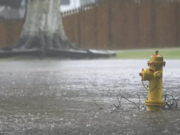
Repeated rounds of rain have left the ground across North Texas heavily saturated. Any additional heavy rain is more likely to run off into streets, creeks, and low-lying areas instead of soaking in.
Multiple water rescues have already occurred in the metroplex, and conditions could worsen with another 1 to 3 inches. Flash flooding can develop quickly, especially in urban areas with poor drainage.
Friday Morning Commuters Should Avoid Flooded Roads
Drivers across Dallas, Fort Worth, and surrounding cities should allow extra time and expect flooded roadways during the Friday morning commute. Underpasses and low-water crossings are especially dangerous during heavy rain.
Never drive through water-covered roads, since just a small amount of moving water can sweep a vehicle away. Residents should keep checking radar and local alerts until the heavy rain moves out late Friday morning.
Stay with bananatreenews.today for the latest weather updates and local forecast coverage.