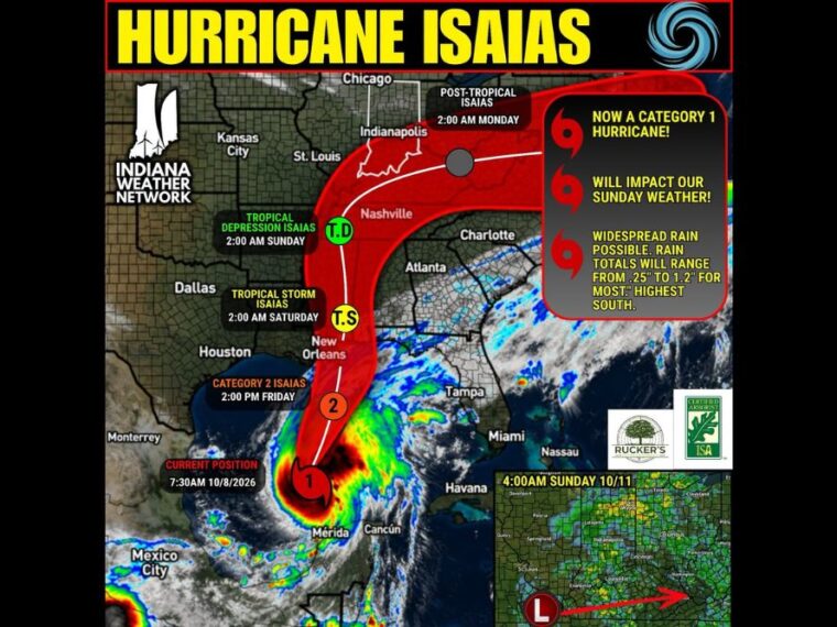
INDIANAPOLIS, IN — Isaias became the first hurricane of the 2026 Atlantic season Thursday morning, reaching Category 1 strength in the Gulf. The storm is expected to strengthen into a Category 2 hurricane before landfall, then weaken quickly after moving inland. Significant impacts are expected along the Gulf Coast of Louisiana, Mississippi, Alabama, and the Florida Panhandle. By Sunday, the weakened post-tropical system is expected to bring a steady rain to Indiana.
Isaias Declared a Category 1 Hurricane Thursday Morning
As of 7:30 AM Thursday, Hurricane Isaias was located over the southern Gulf, north of the Yucatan Peninsula. The storm became the first hurricane of the season and continues to organize over warm waters.
Isaias is forecast to reach Category 2 strength by around 2 PM Friday as it moves north. The storm is then expected to weaken quickly as it approaches and crosses the coast.
Gulfport, Mobile, and Pensacola Could See a Direct Hit
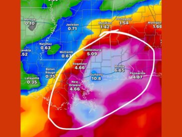
The cities of Gulfport, Mississippi, Mobile, Alabama, and Pensacola, Florida, could see a direct hit from Isaias. Coastal Louisiana, Mississippi, Alabama, and the Florida Panhandle face the most significant impacts.
Residents in these areas should prepare for strong winds, heavy rain, and possible storm surge. Following guidance from local emergency officials is critical as the storm approaches.
Storm Weakens Rapidly After Moving Inland
Isaias is forecast to weaken to a tropical storm by around 2 AM Saturday as it moves inland over Mississippi. By 2 AM Sunday, it is expected to become a tropical depression near the Tennessee Valley.
The system is forecast to become post-tropical by 2 AM Monday as it moves through the Ohio Valley. At that point, it will have lost most of its tropical characteristics.
Indiana Sees Steady Rain Sunday With Breezy Conditions
By Sunday morning, Isaias will be a weak post-tropical system moving through the Ohio Valley. No strong winds are expected in Indiana, though breezy conditions are possible.
The system could bring a steady rain across Indiana on Sunday, especially in southern Indiana where rain is needed. The bulk of the rain is expected early Sunday morning, with scattered showers lingering into the afternoon.
Rain Totals Range From a Quarter Inch to 1.25 Inches
Rainfall totals across Indiana are generally expected to range from 0.25 to 1 inch. Some locations could see up to 1.25 inches, though not everyone will reach that amount.
The highest totals are expected in southern Indiana, closest to the track of the system. Residents should plan for a wet Sunday morning and keep checking forecast updates as Isaias moves north.
Stay with bananatreenews.today for the latest weather updates and local forecast coverage.