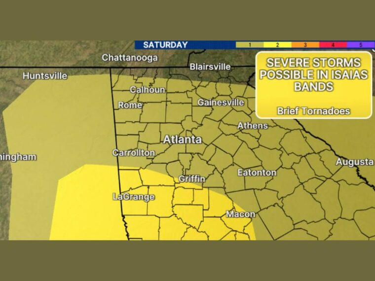
ATLANTA, GA — North Georgia will sit on the east side of Isaias on Saturday, the area that typically carries the highest risk for brief tornadoes from tropical systems. Even a small amount of instability could be enough for brief spin-up tornadoes in tropical rain bands. The greatest tornado risk is mainly south and west of Atlanta. Strong wind gusts of 30 to 40 mph are also likely Saturday, with some higher gusts possible.
Highest Severe Risk Focuses South and West of Atlanta
The Level 2 severe threat area covers parts of west-central Georgia south and west of Atlanta. LaGrange, Griffin, and areas toward Macon fall within this zone, along with parts of eastern Alabama.
Brief tornadoes are the main severe weather concern in Isaias’ rain bands. These tornadoes can develop quickly and with little warning as bands move through.
Level 1 Risk Covers Atlanta and North Georgia
A Level 1 severe threat covers most of north Georgia, including Atlanta, Rome, Calhoun, Gainesville, and Athens. The marginal risk also extends east toward Augusta and west into Alabama near Birmingham and Huntsville.
While the tornado risk is lower in these areas, a brief spin-up cannot be ruled out. Residents should stay alert for warnings throughout the day Saturday.
Wind Gusts Reach the 30s and 40s by Saturday Midday
The wind gust forecast for 12 PM Saturday shows gusts near 41 mph in Blairsville, Calhoun, and Carrollton. Rome is expected near 39 mph, while Atlanta, Gainesville, and LaGrange reach around 38 mph.
Athens is forecast near 36 mph, while Griffin and Eatonton see slightly lower gusts near 32 and 31 mph. Some locations could experience gusts higher than forecast.
Pressure Difference Drives Strong Winds
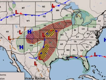
The strong winds are being driven in part by a large pressure difference across the region. High pressure sits to the northeast, while a weakening Isaias moves to the west.
That pressure gradient will keep winds gusty for much of Saturday. Winds will be felt across a wide area, not just near the storm’s rain bands.
Wet Ground Increases Risk of Downed Trees and Power Lines
Gusts of 30 to 40 mph combined with very wet ground could easily bring down trees and power lines. Saturated soil makes it easier for trees to uproot during strong winds.
Residents should prepare for possible power outages and secure loose outdoor items. Staying weather aware and having a way to receive warnings Saturday is strongly recommended.
Stay with bananatreenews.today for the latest weather updates and local forecast coverage.