CHARLOTTE, NC — A beautiful stretch of fall weather is ahead for Charlotte and the Carolinas as a front continues moving south and helps clear out the skies. Temperatures climb into the mid-70s Monday before dropping into the 50s Monday night. Highs only reach the upper 60s Tuesday and Wednesday, with overnight lows dipping into the upper 40s. Attention then turns to another potential rainmaker this weekend, with timing currently favoring Saturday night into Sunday.
Front Pushes South as Rain Band Slides Toward the Coast
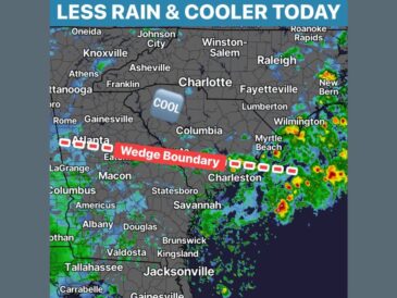
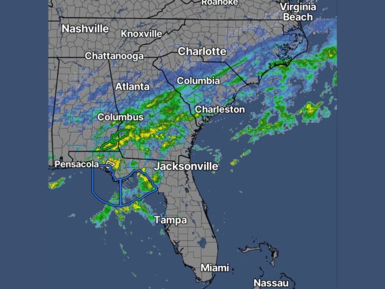
The front responsible for recent rain continues to migrate south through the Southeast on Monday. Radar shows a band of rain stretching from near Atlanta and Columbus, Georgia, northeast through Columbia and toward the South Carolina coast.
Lighter rain is also lingering along the North Carolina coast and offshore. As the front keeps moving south, skies are expected to gradually clear across the Carolinas.
Heavier Rain Focuses on South Georgia and the Florida Big Bend
Some of the heaviest rain on radar is focused near the Georgia and Florida border, close to the Florida Panhandle and Big Bend. Several weather alerts are outlined across southwest Georgia and the Big Bend coastline.
Rain is also falling over Gulf waters near Pensacola and west of Tampa. Jacksonville, Tampa, and Miami are mostly dry on radar, while Atlanta and Charlotte are seeing only light lingering rain.
Mid-70s Monday Gives Way to a Cool Night in the 50s
Monday afternoon highs are expected to reach the mid-70s across the region. Clearing skies behind the front will allow temperatures to fall quickly after sunset.
Overnight lows Monday are expected to drop into the 50s. The cooler night will set the stage for an even more refreshing stretch of weather.
Upper 60s Tuesday and Wednesday With Crisp Upper 40s Nights
Tuesday and Wednesday will bring true fall weather, with highs only reaching the upper 60s. Overnight lows are expected to dip into the upper 40s, giving mornings a crisp feel.
These conditions are ideal for opening windows and enjoying time outdoors. The comfortable air is expected to stick around for the next several days.
Weekend Rainmaker Favors Saturday Night Into Sunday
After several pleasant days, attention shifts to another potential weekend rainmaker. Current timing favors rain arriving Saturday night and continuing into Sunday.
Details on rainfall amounts and timing could shift as the week goes on. Residents with weekend plans should keep checking updated forecasts in the days ahead.
Stay with bananatreenews.today for the latest weather updates and local forecast coverage.