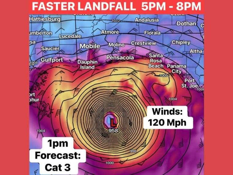
PENSACOLA, FL — A special advisory from the National Hurricane Center has upgraded Isaias to a Category 3 hurricane with sustained winds of 120 mph. New reconnaissance data confirms the storm has strengthened as it approaches the northern Gulf Coast. Landfall is expected along the Florida Panhandle between 5 and 8 PM Friday. Even with some weakening before landfall, significant impacts remain likely along the coast.
Isaias Strengthens to a Major Hurricane
Isaias reached Category 3 strength on Friday, making it a major hurricane. Hurricane Hunter aircraft collected data confirming the storm’s sustained winds of 120 mph.
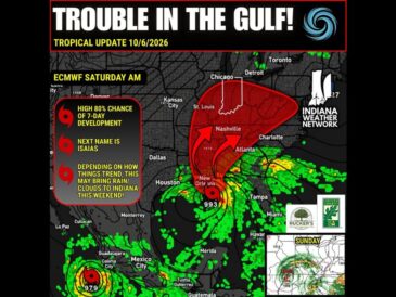
The 1 PM forecast showed the storm’s center south of the Florida Panhandle, with a central pressure near 958 millibars. The storm is moving faster than earlier forecasts, bringing landfall sooner than expected.
Landfall Expected Between 5 and 8 PM
Landfall is expected along the Florida Panhandle between 5 and 8 PM Friday. Communities including Pensacola, Santa Rosa Beach, and Panama City are near the projected landfall zone.
The biggest question is how much the storm will weaken before reaching the coast. Even if winds decrease by about 10 mph, Isaias would still bring dangerous conditions.
Storm Surge Approaching 7 Feet
Storm surge of up to around 7 feet is possible along parts of the coast. Low-lying coastal areas, beaches, and bays face the greatest risk of dangerous flooding from rising water.
Residents in surge-prone areas should follow all evacuation orders from local officials. Storm surge is often the most life-threatening hazard during a landfalling hurricane.
Coastal Wind Gusts Near 100 MPH
Wind gusts near 100 mph are possible along the coast as Isaias moves ashore. Gusts of that strength can cause major damage to trees, power lines, roofs, and weaker structures.
Strong winds are also expected to spread inland across areas near Mobile, Crestview, and Chipley. Widespread power outages are likely across the region.
Tornado Risk Grows as the Storm Pushes Inland
A tornado risk is expected as Isaias moves inland Friday evening and night. Tornadoes in hurricane rain bands can form quickly and with little warning.
Residents across the Florida Panhandle, southern Alabama, and nearby areas should have multiple ways to receive warnings. Sheltering in an interior room away from windows is the safest option during the storm.
Stay with bananatreenews.today for the latest weather updates and local forecast coverage.