ALBUQUERQUE, NM — The immediate danger from Hurricane Polo has shifted from falling rain to the water already on the ground, as runoff continues to drive flash flooding across parts of the Southwest. The storm is now a tropical storm, but its moisture and a separate low-pressure system moving in from the west are still affecting the region.
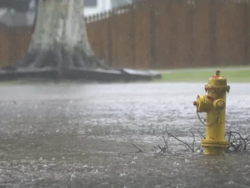
National Weather Service meteorologist Carter Greulich said New Mexico is on the back end of that combined system. Even as the center of the weather pattern moves on, communities are still dealing with saturated ground, swollen waterways, and roads that have not had time to dry out.
Flood watch remains in place along and north of Interstate 40
In northern New Mexico, a flood watch remains active through midnight along and north of the Interstate 40 corridor. Forecasters expect another 1 to 2 inches of rain in many places, with isolated higher-elevation totals of 3 to 4 inches possible.
That amount may be enough to keep flash flooding going in areas that have already seen days of rain. Greulich said the threat is tied not only to new rainfall, but also to water moving downhill into creeks, arroyos, and river systems that are already carrying a heavy load.
The Pecos River east of Santa Fe was under a river flood warning, reflecting the risk that runoff could continue to push levels higher. Officials are also watching for a small but real chance of mudslides or landslides on steep mountain slopes.
Closed roads in Eddy County and Artesia may take time to reopen
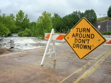
In Eddy County, including Artesia, roads that had already flooded remained closed. Greulich said the problem there is not just the rain that has fallen, but the time it takes for water to drain away after the storm has passed.
Even with little additional rain expected in that area, low spots and roadways can stay dangerous until the runoff eases. That means travel problems may continue after the most intense weather has moved elsewhere.
Floodwater on roads can also hide damage beneath the surface, making it harder for local crews to judge when a route is safe again. For residents and drivers, the message remains the same: conditions can change quickly, and a road that looks passable may still be hazardous.
Southern New Mexico still facing warnings near Roswell and Ruidoso
Farther south, flood warnings were in effect after reports of inundated roads on New Mexico State Road 246 west of Roswell and in Lincoln County near Ruidoso. Those warnings point to areas where runoff has already made travel difficult and where additional storms could create fresh problems.
Most of southern New Mexico was expected to see only isolated to scattered storms later in the day, but the risk was not spread evenly. Saturated burn scars near Ruidoso remained a concern if storms developed overhead.
Greulich described that burn-scar threat as low-confidence, but not impossible. Even limited rainfall can be enough to send water and debris rushing through areas that burned in past wildfires, especially when the ground can no longer absorb much more moisture.
Western and central states also under flood watches
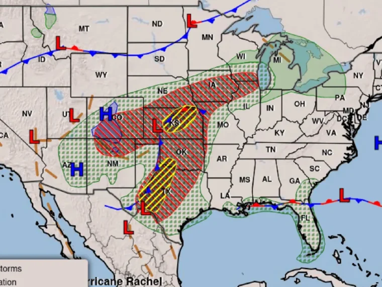
The weather pattern was not confined to New Mexico. Heavy rain also affected parts of southern Colorado and the entire southern and eastern portions of that state, while central Oklahoma and western Kansas were under flood watch as well.
Small pockets of New Mexico and Arizona were still under flood warning. That broader footprint shows how the storm remnants and the incoming low-pressure system have spread across a wide section of the region, bringing a mix of warnings, watches, and lingering travel hazards.
Although the heaviest rain has already fallen in some places, the danger can last well after the strongest bands move away. Flood watches mean conditions could still support new flooding if storms redevelop or if runoff continues to build in vulnerable areas.
Dryer weather may return, but crews still face a long cleanup
Greulich said New Mexico should turn mostly dry after Wednesday, with only a chance of scattered showers and thunderstorms early or midweek next week. At the time of the interview, rainfall projections for those later storms were not considered concerning.
For communities already coping with floodwater, though, there is no quick reset. Water has to recede before damage can be assessed and before roads, rivers, and drainage systems return to normal. In the meantime, officials must keep tracking flood-prone areas, closed roads, and any new storm that could fall on already saturated ground.
That is why the current forecast remains focused less on the hurricane itself and more on the aftereffects it left behind. In much of the region, the greatest risk now comes from what the storm already put in motion.
What forecasters are watching next as runoff continues
Forecasters will continue to monitor river levels, burn scars, and mountain slopes as the system slowly loses strength. The most immediate concern remains whether additional rainfall in northern New Mexico can push already stressed waterways above safe levels.
Greulich said the overall pattern is still capable of producing localized problems even where widespread rain is not expected. That means isolated flash flooding, road closures, and minor slope failures remain possible in the most vulnerable spots.
For now, the key story is persistence. The rain has eased in some places, but the impacts are still unfolding across New Mexico and parts of the broader Southwest and Mountain West.