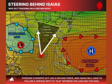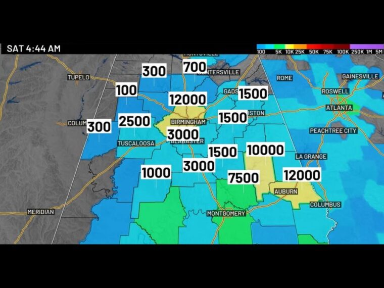
BIRMINGHAM, AL — About 290,000 customers were without power across Alabama early Saturday as Post-Tropical Cyclone Isaias moved through the state. The center of Isaias was located about 25 miles south-southwest of Montgomery, moving north at 14 mph, with most of the rain north of the center. The National Hurricane Center has issued its final advisory on the system. The strongest winds are expected to shift north and exit the area around 11 AM.
Tropical Storm Warning Replaced With Wind Advisory
The Tropical Storm Warning for Alabama has been canceled and replaced with a Wind Advisory. High Wind Warnings remain in effect for northeast Alabama counties, where peak gusts are still possible, especially in elevated terrain.
The High Wind Warning area includes locations near Gadsden, Anniston, and Guntersville. Wind Advisories cover much of the rest of central and north Alabama.
Gusts Top 50 MPH Across Central and East Alabama
Some of the strongest gusts early Saturday were 53 mph in Alexander City and Rockford, with 52 mph in Oneonta. Birmingham and Ashland each recorded gusts near 49 mph, while Gadsden reached 48 mph.
Talladega saw gusts near 43 mph, with Haleyville at 41 and Centreville and Clanton near 40. Hoover reported 36 mph, while Tuscaloosa and Greensboro were near 31 mph.
Power Outages Climb Across the Southeast
Outage totals topped 290,000 customers in Alabama, with about 95,000 in Georgia. Florida had roughly 430,000 customers without power after Isaias moved ashore.
Downed trees and debris may be blocking roads in some areas. Residents should stay clear of downed power lines while crews assess damage and work to restore service.
Winds Gradually Ease Through the Day
Gusts may still exceed 40 mph at times through daybreak, especially across northern and northeastern counties. The strongest winds are expected to move out of the area by around 11 AM.
It will remain quite breezy through the afternoon, with winds gradually decreasing to 10 to 15 mph Saturday night. A few scattered showers will linger, but significant impacts should be over by late morning.
Tornado Risk Shifts East of Alabama
The risk for isolated tornadoes has shifted east of Alabama into neighboring areas. Radar early Saturday showed no lightning across Alabama as the heaviest rain moved north.
Residents should continue using caution, especially while traveling, as conditions improve. Those without power can follow updates through mobile weather apps and local media.
Stay with bananatreenews.today for the latest weather updates and local forecast coverage.