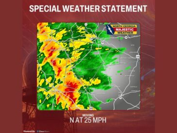
ATLANTA, GA — More than 100,000 customers were without power across Georgia early Saturday as Isaias pushed north through the state. Nearly 20,000 of those outages were in Metro Atlanta. Wind and rain continued statewide Saturday morning, with Macon recording the strongest gust at 68 mph. Tornadoes and flash flooding remain serious concerns through the afternoon.
Wind Gusts of 40 to 60 MPH Continue Through Early Afternoon
Wind gusts of 40 to 60 mph are expected to continue through the early afternoon, with peak gusts arriving Saturday morning. Many locations have already reported gusts above 50 mph.
Early Saturday readings showed gusts near 56 mph in northwest Georgia, 50 mph near Marietta, and 45 mph near Gainesville. Gusts of 41 mph were reported near Newnan and Griffin, with 35 mph near Eatonton.
High Wind Warnings Cover North and West Georgia
High Wind Warnings are in effect across north and west Georgia, including Dalton, Rome, Canton, Atlanta, Carrollton, and Griffin. Gusts of up to 50 mph are possible in these areas, with stronger gusts possible in the mountains.
A Wind Advisory covers areas farther east, including Athens, Eatonton, and Thomaston, where gusts up to 40 mph are possible. These alerts run through early Sunday.
Power Outages Climb Across Central and West Georgia
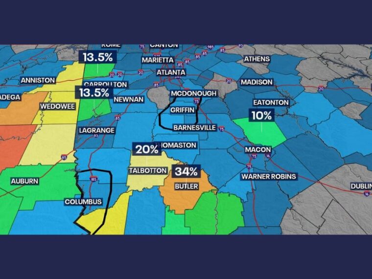
Some of the highest outage percentages were reported in central and west Georgia. Areas near Talbotton were seeing about 34 percent of customers without power, with about 20 percent near Thomaston.
Areas near Rome and Carrollton were each near 13.5 percent, while areas near Eatonton were around 10 percent. More outages are possible as strong winds continue and saturated ground loosens trees.
Strong Tornadoes Possible Along and South of I-85
Tropical tornadoes remain a concern Saturday afternoon as temperatures warm. The threat is focused along and south of the Interstate 85 corridor.
While tropical tornadoes are often weak and short-lived, one or two strong tornadoes cannot be ruled out this time. Residents should have a reliable way to receive severe weather alerts.
Flash Flooding Could Bring Up to 8 Inches of Rain
A zone from Metro Atlanta into eastern Georgia faces the greatest flash flood risk, with up to 8 inches of rain possible in some spots. Widespread totals of 1 to 4 inches are expected across Metro Atlanta and north Georgia.
Creeks and rivers could rise into flood stage if heavier bands set up over their basins. Residents should avoid flooded roads and keep monitoring local alerts through the day.
Stay with bananatreenews.today for the latest weather updates and local forecast coverage.